

Satellite Data Reveals a Turning Point
Scientists began using satellites to map mangrove forests in the 1970s after the launch of the first Landsat satellite. For decades, the data told a story dominated by loss and decline. The new research, led by environmental scientist Zhen Zhang of Tulane University, analyzed Landsat imagery collected between 1984 and 2023, tracking changes in the extent and density of mangrove canopy globally. The team tallied losses of nearly 3,000 square kilometers between 1984 and 2010, followed by an unexpected increase of nearly 2,000 square kilometers after 2010. These are the first global mangrove maps to cover such an extended period, providing an unprecedented long-term view of these critical coastal ecosystems.
Asia Leads the Recovery
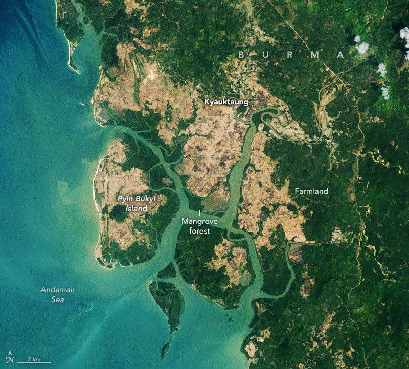
One of the most notable reversals has occurred in Southeast Asia, particularly in Burma (Myanmar). The country lost mangroves rapidly during the 1980s and 1990s due to agricultural expansion, aquaculture development, and firewood harvesting in coastal areas. The trend reversed around 2010, when mangrove area began expanding in many places. Researchers attribute the turnaround to increased awareness and restoration efforts following the devastating 2004 Indian Ocean tsunami, strengthened legal protections for forests, and high rates of sedimentation that opened new mudflats for colonization. Burma lost 28.6 percent of its mangrove area between the 1980s and 2010, but has since seen its mangrove area grow by about 10 percent.
Ecological and Climate Significance
Mangrove trees are relatively small, averaging about 13 meters in height, but their ecological impact is enormous. Mangrove ecosystems store up to four times as much carbon as taller inland tropical forests. The trees protect coastal communities from erosion and storm surges, and their distinctive stilt-like roots provide vital habitat and nursery grounds for fish, shrimp, crabs, and other marine life. Around the mouth of the Amazon River and in northern Australia, extensive sediment deposition has created new mudflats that mangroves have successfully colonized. At the northern and southern edges of their range, including the southeastern United States, warming temperatures and fewer freezes have also allowed mangroves to expand into previously inhospitable areas.
Ongoing Challenges Remain
Despite the encouraging global trend, significant challenges persist. Substantial mangrove losses in the Niger Delta have reduced total mangrove area in West and Central Africa since 2010. North America and southern Africa have experienced widespread degradation after tropical cyclones devastated broad swaths of mangroves. Zhang cautioned that the global successes of the past decade should not be seen as grounds for complacency. About two-thirds of the expansion resulted from mangroves colonizing new areas, while the remaining third came from restoration and regrowth in degraded zones. The findings underscore that conservation and slowing deforestation can produce huge positive impacts when coupled with natural expansion and regeneration.



Join the Conversation
Moderated reader discussion · Community standards apply